Chile itinerary planning made simple: digital tools for stress-free trips
I still remember my first time landing in Santiago after a 14-hour haul from Europe. Groggy, excited, completely overwhelmed—truthfully, my itinerary planning had been more “patchwork panic” than blueprint. I juggled screenshots, half-baked Google Docs, and guidebook scraps…and within hours I was lost in Bellavista, apologizing—in appalling Spanish—to a bemused cab driver with a broken meter. That was back in 2010—pre-Wi-Fi-everywhere, no offline maps, limited translation apps. These days? You can craft a trip through Chile—the world’s skinniest country and (no exaggeration) one of the most geographically dramatic—almost entirely from your phone. Still, too many travelers freeze up or try to wing it, then stress when the unexpected (ferry cancellations, sudden weather shifts, digital booking meltdowns) crops up. My aim here? Give you the no-nonsense, step-by-step Chile itinerary planning flow I wish I had the first time: one that blends smart digital travel tools, curated local insight, and totally human flexibility.1
Why Chile is perfect for digital itinerary planning
While many nations still wrestle with connectivity headaches and incomplete digital listings, Chile stands out—a real paradox, given its wild geography! Major cities (Santiago, Valparaíso), mid-sized hubs (Puerto Varas, La Serena), and even many rural bus terminals now sport pretty reliable Wi-Fi and robust mobile signal (with a prepaid local SIM, Claro or Entel work best in my experience). I’m still not convinced every glacier hamlet in Patagonia will have 5G anytime soon, but most travelers can expect modern infrastructure—especially along the backbone that runs north-south.2
Here’s the thing: Chile’s extreme length—over 4,200 km from Arica to Punta Arenas—means that trying to “see it all” is madness. You have to be strategic, and digital mapping, booking, and review platforms are now so advanced, you can virtually walk every route before ever buying a ticket.3
- Centralized info—no scattered Word docs or lost PDFs
- Real-time booking updates for flights, buses, ferries
- Crowdsourced tips for local eats/hotels (TripAdvisor, Google Reviews—sometimes even Instagram stories!)
- Offline map storage for when the Wi-Fi disappears mid-desert
- Instant messaging with hosts and guides via apps
Chile covers every major biome: driest desert (Atacama), lush winelands, glacial Patagonia, volcanic Lake District, temperate rainforest, Mediterranean coast, and even Polynesian Easter Island. Planning cross-country is not only about distance—but also about totally different climates and cultural rhythms, often within one trip.4
Step 1: Pre-trip research—where to start and what to trust
Confession: Even as a “seasoned” digital planner, I get overwhelmed. Chile throws out dozens of potential starting points—do you anchor the trip around Torres del Paine, the wine valleys, the Atacama Desert, remote Chiloé, or the vibrant capital? I recommend beginning with:
- Official Chile Tourism (Sernatur) for region-by-region guides5
- Lonely Planet’s Chile & Rapa Nui guide (digital version is easier to search and update)
- Photo blogs and Instagram accounts (for both inspiration and current weather/seasonality clues)
- Google My Maps—start pinning dream destinations, must-eats, and can’t-miss events
I’m partial to layering: mapping wishlist spots, checking seasonal/weather info, and only then looking at logistics (flight routes, intercity buses, etc.)—instead of the other way around. That’s saved me from chasing unrealistic distances and slashing “must see” items after realizing they’d require an entire day of transit.
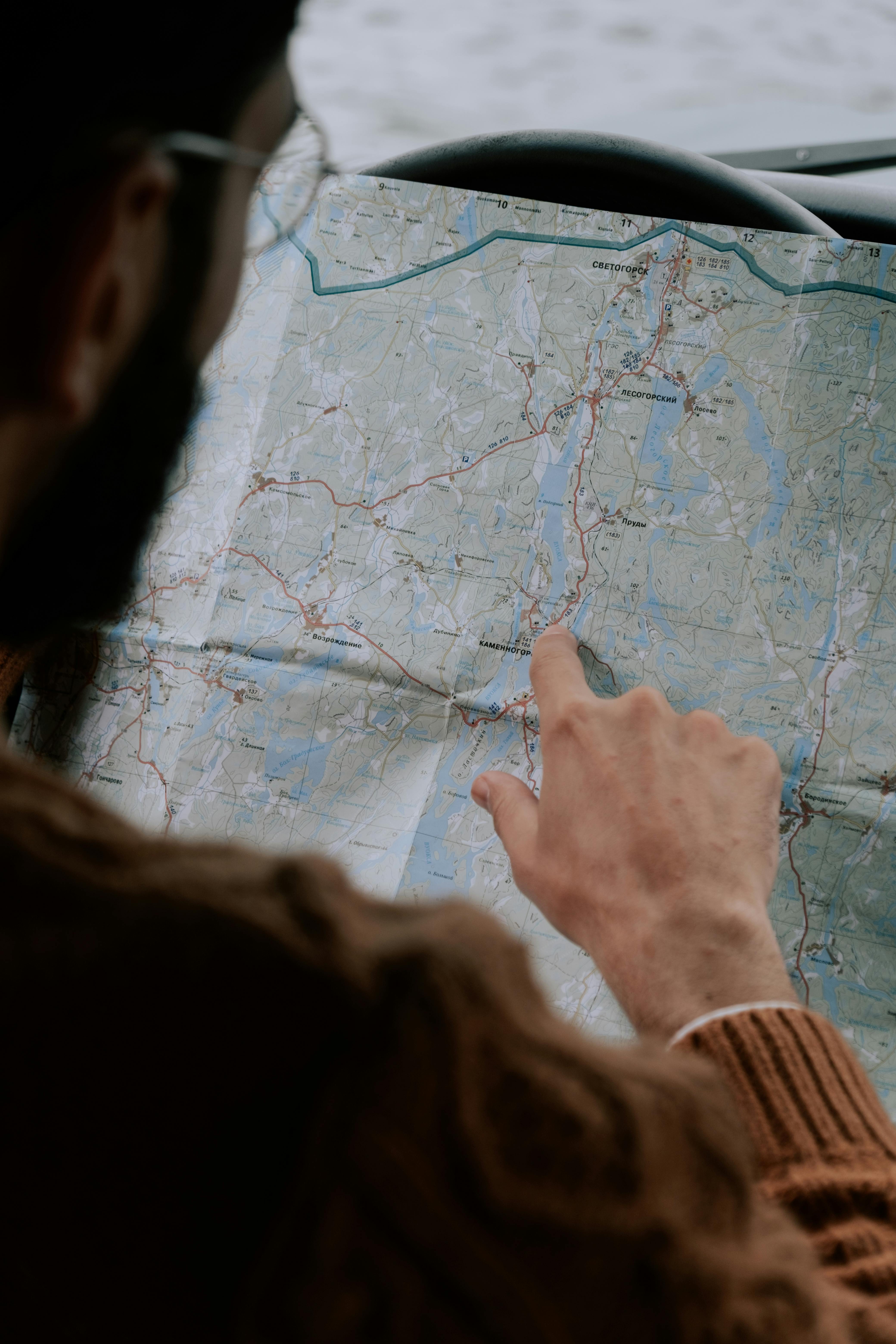
Step 2: Routes and timing—build your backbone with mapping and transit apps
Let me step back a moment. You’ve done your initial dreaming—how do you string those wild, disparate Chilean stops together in a way that’s both exciting y realistic? Here’s my personal framework after years of trial, error, and more than one “stranded at a ferry terminal in Chiloé” moment.
Start with Google Maps—but don’t trust its domestic bus connections blindly. For Chile, Rome2Rio is indispensable; it shows not only transit times, but cross-references flights, buses, and even ferries in a single line. Which reminds me, for Patagonia, especially Torres del Paine and the Carretera Austral, Rome2Rio plus local bus company sites (like Bus-Sur and TurBus) are non-negotiable.6
- Use Google Maps to estimate distances and travel time between anchor cities
- Overlay transport lines with Rome2Rio’s recommendations
- Check for region-specific apps (for example, Puerto Montt’s ferry lines have their own tracking apps)
Sample route templates—flexible yet formulaic
I want to be clear: no single route fits every traveler, but based on personal experience and advice from Chilean friends, here are two “starter templates” you can build upon.
| Focus | Route Highlights | Optimal Days | Best Digital Tools |
|---|---|---|---|
| Atacama Desert Wonders | Santiago → Calama → San Pedro de Atacama (salt flats, geysers, star-gazing) | 6-8 | Rome2Rio, Google Maps, Star Walk (astronomy app), Booking.com |
| Patagonia and Glaciers | Punta Arenas → Puerto Natales → Torres del Paine (glaciers, hiking, boat tours) | 8-12 | Rome2Rio, Wikiloc (trail maps), Bus-Sur app, Hostelworld |
| Lake District Loop | Puerto Varas → Chiloé Island → Valdivia | 5-7 | Ferry schedulers, Google My Maps, Airbnb, ParqueOn |
Step 3: Booking smarter—apps, platforms, and Chile’s digital curveballs
Booking the “backbone” (long-distance buses or flights) is usually the easy part—Sky Airline, LATAM, JetSMART for flights; BusBud for bus tickets. Pro tip? Always try the company’s own website too, as they sometimes run promos no available through aggregators.7
But here’s where more digital nuance comes in. For Patagonia, some refugios (mountain huts) can only be reserved via specific local platforms—or even email. During my Torres del Paine trek, I found Fantástico Sur’s platform was both a blessing and a curse: English toggles weren’t reliable, and the credit card payment system failed until I switched to another browser. What really strikes me? Having patience with clunky sites and a few manual confirmations is still occasionally part of Chile explored right.
- Domestic flights: Sky Airline, LATAM, JetSMART (always cross-check prices with Kayak/Google Flights)
- Long-distance buses: BusBud, Recorrido.cl, TurBus
- Ferries (Chiloé, Patagonia): Navimag, Cruz del Sur, direct company sites
- Accommodations: Booking.com, Hostelworld, Airbnb, and in Patagonia, sometimes direct calls or emails ARE still part of the process
Step 4: Weather, seasons, and local events—decoding the Chilean calendar
Chile’s seasons are flipped for Northern Hemisphere travelers (summer: December-February, winter: June-August), but—here’s the kicker—even within one week, you might roast in the Atacama and freeze in Patagonia! I wish I could say I learned this the easy way, but the shock of 30°C differences in two internal flights is real.
| Región | Best months | Major events | Weather notes |
|---|---|---|---|
| Atacama Desert | March–May, Sept–Nov | Fiesta de San Pedro (June), Star Gazing Festivals | Hot days, freezing nights |
| Patagonia | Nov–March | End of the World Marathon, Penguin breeding (Nov-Jan) | Unpredictable, windstorms, pack for all four seasons |
| Central Chile | Sept–May | Vendimia (wine harvest festival, March-April) | Mediterranean, rainy in winter |
I’m still learning to triple-check transit and event schedules during national holidays—expect crowds and fewer transport runs during Chilean Independence festivities (September 18-19) and New Year.
Step 5: Curated day-by-day plans—templates, samples, and local secrets
I know, I know—you’re probably thinking “But cómo do I turn region picks and tool lists into an actual itinerary?” Here’s where the digital revolution shines for real travelers in Chile. Last year, while prepping for the Lake District trek, I used a mashup: Google My Maps for day-by-day plotting, WhatsApp to schedule with local guides, and Pocket for storing restaurant recs and transport screenshots.
Let me give you a real breakdown for a 7-day “Atacama to Lake District” itinerary, with every digital step included:
- Arrive Santiago (download airport transfer app, check Beat/Uber for city transport)
- Fly to Calama/Atacama (use Rome2Rio route guide, book airport transfer shuttle)
- San Pedro de Atacama (offline Google Maps for walking, Star Walk app for tours, Check TripAdvisor events)
- Fly to Temuco, enter Lake District (schedule airport pickup, check bus times via Recorrido.cl)
- Puerto Varas—day at Lago Llanquihue (Book local cycling on GetYourGuide, scout local eats with Google Reviews)
- Chiloé Island—use ferry tracker for real-time updates, offline maps, WhatsApp guide chat
- Return Santiago—skim missed sites for next trip, sync notes/photos before departure
Block your core route and key bookings (flights, buses, hotels), but always leave 1-2 “open” days for spontaneous local discoveries or to recover when an app-notified delay hits. It feels counterintuitive, but that breathing room is what makes Chile feel adventurous—not panicked.
Step 6: The digital toolkit—what apps and resources work best, really?
- Navigation/Maps: Google Maps (with offline areas saved for all your destinations); Maps.me if you want even more local trails in Patagonia
- Transport: Rome2Rio for cross-country routes, Recorrido.cl for buses, local airlines apps, Navimag/Cruz del Sur for ferries
- Accommodation: Booking.com and Hostelworld for hostels/hotels; Airbnb for more rural or quirky stays
- Trail and activity planning: Wikiloc for hiking trails, Star Walk for astronomy tours, GetYourGuide for booked excursions
- Idioma: Google Translate, but also DeepL for more grammatical Spanish; I keep both on my phone
- Conectividad: WhatsApp for direct texting/guides/local contacts—a must
- Seguridad: Red de Emergencias (local alert app), SOSAFE (citywide alerts in bigger areas)
Honestly, there’s still no “one app to rule them all.” I used to think multitool superapps were the answer, but in Chile, pairing a few best-in-category options is usually less frustrating.8
Chile is home to the southernmost city in the world, Puerto Williams—reachable by ferry from Punta Arenas, with digital tracking now making winter schedules much less of a mystery (and less of a risk for stranded travelers).
Step 7: Safety, language, and surviving when the signal drops (because it will)
Ever found yourself standing at a rural bus stop watching clouds wheel overhead, phone signal completely dead, Spanish phrasebook app frozen? Welcome to real travel. This happened to me in northern Chiloé, rain coming down, only to have a local farmer hop over a fence and help direct me to the right colectivo (shared taxi). Those are the moments apps just can’t replace.
Most Chileans in tourism are patient with gringos, but do try to learn a dozen common phrases. While previously I relied entirely on a phrasebook, now Google Translate’s audio feature is a lifesaver. For medical and emergency info, I use Red de Emergencias (local alerts) and keep embassy/safety contacts (phone and copied in your digital notes). Pro tip: screenshot your most critical info; don’t rely on screenshots in “cloud-only” apps.
Step 8: Packing, budgeting, and logistics—digital systems that save your sanity
Packing for Chile boils down to one word: layers. The digital revolution hasn’t yet solved the microclimate problem—Patagonia can spit icy rain, Atacama can fry you by noon and freeze you at midnight, and Santiago can swing from chilly morning fog to t-shirt afternoons. My advice, after a few fiascoes? Use packing list apps (like PackPoint or simple Google Keep), color-code items for each region, and—even if you’re 100% digital—bring paper copies of all key docs (passport, insurance, vaccine proof).
- Plan a digital AND a paper backup for passport and insurance (nothing ruins a trip like a phone bricked in the Andes and no ID at a checkpoint)
- Pre-download major booking receipts to device (cloud may not work in remote areas)
- Budget with real-time tracking: Trail Wallet or TravelSpend app, always account for 20% “surprise” jump in on-the-ground costs
- Save all emergency phone numbers as local contacts—don’t rely on hotel Wi-Fi to get help
Let me clarify—no app replaces “margin for error.” Case in point: last trip to Torres del Paine, my power bank bit it the second day. No charging for three days, and yes, my digital itinerary became a paper map with hasty pen scribbles. I now always charge devices whenever I can, carry two chargers, and stick to local advice for weather delays.
Personal lessons, mistakes, and must-dos (so you can avoid them)
- Never assume the fastest route on Google Maps applies in Patagonia—local bus or ferry schedules may run only on certain days or be canceled if winds pick up (happened to me at least thrice)
- Always screenshot your day’s plan before you lose Wi-Fi
- When in doubt, ask—Chileans are patient and eager to help, especially if you make an effort with Spanish
- Leave open “buffer” days and always budget more money for local, spontaneous experiences
- If you get stranded, there’s probably a colectivo or minibus if you ask around—even if the app says “no rides”
Some of my favorite memories in Chile weren’t planned—an unmarked seafood shack in Valparaíso, a rainstorm that turned a hike into a dance party with soaked locals, a bus detour to a village festival. Allow for (and even invite) these.
Key references and further reading
Referencias